The WISE Portal provides access to hydrological model outputs from the CoSWAT (Community SWAT+) framework. The datasets below represent calibrated simulation results covering the globe and hydrological variables. All data is freely available for research, education, and policy support under the MIT License.
Each dataset includes spatially distributed raster outputs at monthly temporal resolution, covering the period 1980–2020. Variables span the full water balance including precipitation, evapotranspiration components, surface and subsurface runoff, snow dynamics, and soil moisture.
Aster GDEM
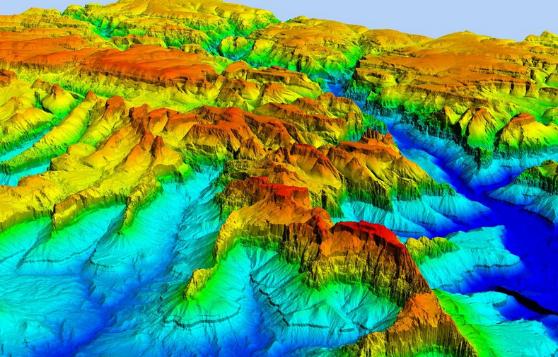
Version 3 of the Advanced Spaceborne Thermal Emission and Reflection Radiometer (ASTER) Global Digital Elevation Model (GDEM) is now available from NASA’s Land Processes Distributed Active Archive Center (LP DAAC). The ASTER GDEM covers land surfaces between 83°N and 83°S, and was produced through automated processing of 2.3 million scenes from the ASTER archive.
The ASTER instrument was built by Japan’s Ministry of Economy, Trade and Industry (METI) and launched aboard NASA’s Terra spacecraft in December 1999. It has an along-track stereoscopic capability using its near infrared spectral band and its nadir-viewing and backward-viewing telescopes to acquire stereo image data with a base-to-height ratio of 0.6. The spatial resolution is 15 meters in the horizontal plane, with a 60 kilometer by 60 kilometer ground area.
The methodology used to produce the ASTER GDEM involved automated processing of 2.3 million scenes from the ASTER archive, including stereo-correlation to produce individual scene-based ASTER DEMs, masking to remove cloudy pixels, stacking all cloud-screened DEMs, removing residual bad values and outliers, averaging selected data to create final pixel values, and then correcting residual anomalies before partitioning the data into 1° by 1° tiles.
The ASTER GDEM covers land surfaces between 83°N and 83°S and comprises 22,912 1° by 1° tiles. Tiles that contain at least 0.01% land area are included. The ASTER GDEM is distributed in GeoTIFF file format with Geographic latitude/longitude coordinates and a 1 arc-second (30 m) grid of elevation postings. It is referenced to the WGS84/EGM96 geoid. Studies to validate and characterize the ASTER GDEM confirm that accuracies for this global product are 20 meters at 95% confidence for vertical data and 30 meters at 95% confidence for horizontal data.
in elevation void area due to the increase of ASTER stereo image data and improved process, and a decrease in water area anomaly data due to using new global water body data to be described later.in elevation void area due to the increase of ASTER stereo image data and improved process, and a decrease in water area anomaly data due to using new global water body data to be described later.
Comparison between GDEM
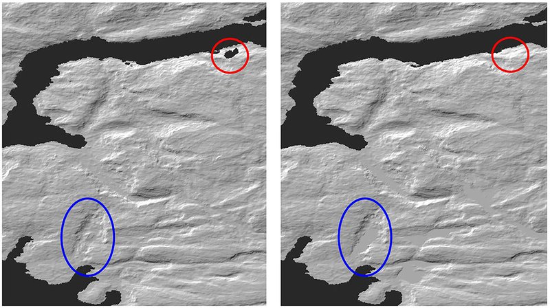
Version 2 and 3 (Left: Version 2, Right: Version 3)
Red circle: elevation void area, Blue circle: water area
With this release, an additional global product is now available: the ASTER Water Bodies Database (ASTWBD). This raster product identifies all water bodies as either ocean, river, or lake. Each GDEM tile has a corresponding Water Body tile. This data product provides the only water mask covering nearly the entire surface of the Earth.
ESA Landuse Map

The ESA GlobCover land cover map is a global land classification product at 300 m spatial resolution, generated from 19 months of data collected by Envisat's MERIS instrument between December 2004 and June 2006.
The map classifies land surfaces into 22 classes based on the FAO Land Cover Classification System (LCCS). Validation by 16 experts using over 3,000 reference points showed an overall accuracy of 73% weighted by area.
In the CoSWAT framework, the ESA land cover map defines land use types for each hydrological response unit (HRU), determining vegetation parameters such as leaf area index, canopy height, and root depth that drive evapotranspiration and surface runoff calculations in SWAT+.
More information: ESA GlobCover
ISIMIP Weather Forcing

The GSWP3-EWEMBI dataset is a global meteorological forcing product developed for the Inter-Sectoral Impact Model Intercomparison Project (ISIMIP). It merges data from the Global Soil Wetness Project Phase 3 (GSWP3) with the EartH2Observe-WFDEI-MERRA2-Bias-adjusted-IntERim (EWEMBI) reanalysis to provide a continuous, bias-corrected climate record.
Variables: Daily precipitation, minimum/maximum temperature, solar radiation, wind speed, relative humidity, and surface pressure.
Resolution: 0.5° × 0.5° global grid at daily temporal resolution.
Period: 1979–2016 (EWEMBI segment), extended back to 1901 when combined with GSWP3.
In the CoSWAT framework, GSWP3-EWEMBI provides the atmospheric forcing that drives all hydrological simulations, supplying the precipitation, temperature, and radiation inputs needed by the SWAT+ model at each sub-basin.
More information: www.isimip.org
FAO Soil Map
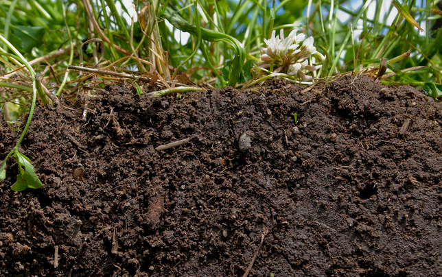
The Harmonized World Soil Database (HWSD) is a comprehensive global soil information resource developed collaboratively by FAO, IIASA, ISRIC-World Soil Information, the Chinese Academy of Sciences, and the Joint Research Centre of the European Commission.
The HWSD is a 30 arc-second (~1 km) raster database containing over 15,000 soil mapping units. It synthesizes regional and national soil data from the SOTER program, European Soil Database, Chinese soil surveys, and the WISE database, harmonized against the foundational 1:5,000,000 FAO-UNESCO Soil Map of the World.
Soil properties include: organic carbon content, pH, water storage capacity, soil depth, cation exchange capacity, total exchangeable nutrients, lime and gypsum contents, salinity, textural class, and sand/silt/clay fractions.
Derived soil qualities: nutrient availability, nutrient retention capacity, rooting conditions, oxygen availability to roots, excess salts, toxicity, and workability — all critical for characterizing hydrological response units in watershed models.
In the CoSWAT framework, HWSD v1.2 provides the soil physical and chemical properties needed by SWAT+ to parameterize infiltration, percolation, lateral flow, and evaporation processes at each hydrological response unit (HRU).
More information: FAO Soils Portal
GLEAM Evapotranspiration

GLEAM (Global Land Evaporation Amsterdam Model) is a satellite-based model that estimates terrestrial evaporation and its components globally. It provides gridded data of transpiration, bare-soil evaporation, interception loss, open-water evaporation, and sublimation, along with root-zone and surface soil moisture, evaporative stress, and potential evaporation.
The model uses the Penman equation driven by satellite observations of surface net radiation, air temperature, wind speed, leaf area index, and vapor pressure deficit. Evaporative stress factors are derived from deep neural networks trained on global eddy-covariance and sapflow measurements.
Versions:
- GLEAM v4.2a: 0.1° resolution, 1980–2024, using satellite and reanalysis data
- GLEAM v4.2b: 0.1° resolution, 2003–2024, using satellite data only
In the CoSWAT framework, GLEAM v4 evapotranspiration data at 0.1° resolution is used as reference data for evaluating simulated ET spatial patterns and magnitudes across global domains.
More information: www.gleam.eu
Methodology
Model Framework
The CoSWAT (Community SWAT+) Framework is a free and open-source solution designed for large-scale hydrological modelling using SWAT+. The framework automates data retrieval, preprocessing, and model setup through Python scripting, operating via a single configuration file that controls all stages: DEM acquisition, land-use processing, soil data preparation, and climate input formatting. It leverages parallel processing on high-performance computing systems to reduce computational demands. The global model operates at 2 km resolution, providing high-fidelity spatial representation of watershed processes.
Input Data
The framework integrates multiple globally available datasets:
- Digital Elevation Model: ASTER Global DEM covering 99% of land surfaces
- Land Use: European Space Agency (ESA) 2007 land cover map at 300 m resolution
- Soils: FAO Harmonized World Soil Database (HWSD) at 1 km² resolution
- Climate Forcing: GSWP3-EWEMBI reanalysis data at 0.5° resolution
- Evaluation Data: GRDC river flow records and GLEAM v4 evapotranspiration dataset at 0.1° resolution
Calibration and Validation
The global CoSWAT model was established without calibration, operating with default SWAT+ parameters across the simulation period 1977–1990 (with a 5-year warmup). Performance evaluation employed the Kling–Gupta Efficiency (KGE) metric for monthly streamflow comparison against GRDC gauging stations, and spatial pattern analysis for evapotranspiration against GLEAM v4 satellite-derived estimates.
Key Results
The uncalibrated global model demonstrated that 78.54% of sampled evapotranspiration points showed differences within ±100 mm compared to GLEAM reference data. For river discharge, 85.31% of evaluated stations demonstrated positive flow correlations, though only 23.02% achieved positive KGE values — indicating that while the spatial patterns and temporal dynamics are well-captured, bias correction through calibration is needed for individual basins.
Reference
Chawanda, C. J., van Griensven, A., Nkwasa, A., Teran Orsini, J. P., Jeong, J., Choi, S.-K., Srinivasan, R., and Arnold, J. G.: CoSWAT Model v1: A high-resolution global SWAT+ hydrological model, Hydrol. Earth Syst. Sci., 29, 6901–6916, https://doi.org/10.5194/hess-29-6901-2025, 2025.